Under the direction of Prof. Dr. Wilfried Hagg and Geodata Manager Alexander Klaus, 27 Bachelor students on the "GeoVisual Design - Geomatics" course carried out a field internship in Füssen in autumn 2024 to develop digital map and visualization projects. The aim was to make Füssen's natural and cultural experiences digitally tangible through modern geovisualizations.
The bachelor's degree course "GeoVisual Design - Geomatics" combines geosciences, computer science and design to make complex environmental and sustainability issues understandable through innovative visualizations and geomedia technologies. The student internship focused on topics and projects that enrich tourism in Füssen in the long term:
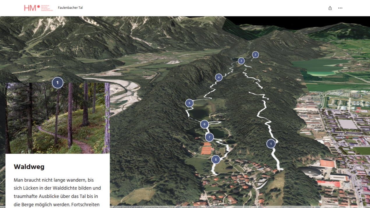
- Nature experiences: Hopfensee circular trail, Faulenbach circular trail, Weißensee circular trail, Forggensee boat trip
- Sightseeing experiences: City tour, museum of the city of Füssen, high castle
- Health and active tourism: Kneipp cycle tour
The students researched in six groups on site in Füssen from October 1 to 4, 2024 and then worked independently on the digital projects. The results were presented as part of an examination in January 2025. The varied examples of a digital expansion of the Füssen tourism offer ranged from an interactive experience map of Lake Forggensee to a virtual hike around Lake Weissensee and 3D visualizations of exhibits in the Füssen City Museum.
Those responsible at Füssen Tourismus und Marketing are delighted with the successful collaboration with Munich University of Applied Sciences and are looking forward to future joint projects.
All information in the linked projects is without guarantee.
